Sunday, December 14, 2014

Our First Cruise to the Western Carribean


This is the first time ever we have gone on a cruise. We kind of spoiled ourselves with the ship we went on. This is the Freedom of the Seas. MS Freedom of the Seas is a cruise ship operated by Royal Caribbean International. It is the namesake of Royal Caribbean's Freedom class, and can accommodate 3,634 passengers and 1,300 crew on fifteen passenger decks. Freedom of the Seas was the largest passenger ship ever built (by gross tonnage) from 2006 until construction of the Royal Caribbean International's Oasis-class ships in late 2009.

To give you an idea of how big this ship is, this is a picture of the promenade deck. It is 5 decks high and runs from the front of the ship to the back and is filled with jewellery shops, liquor stores, cafes, and all kinds of souvenir shops. It is virtually a small town built into this ship. At nights they have parades and all kinds of music entertainment to enjoy.


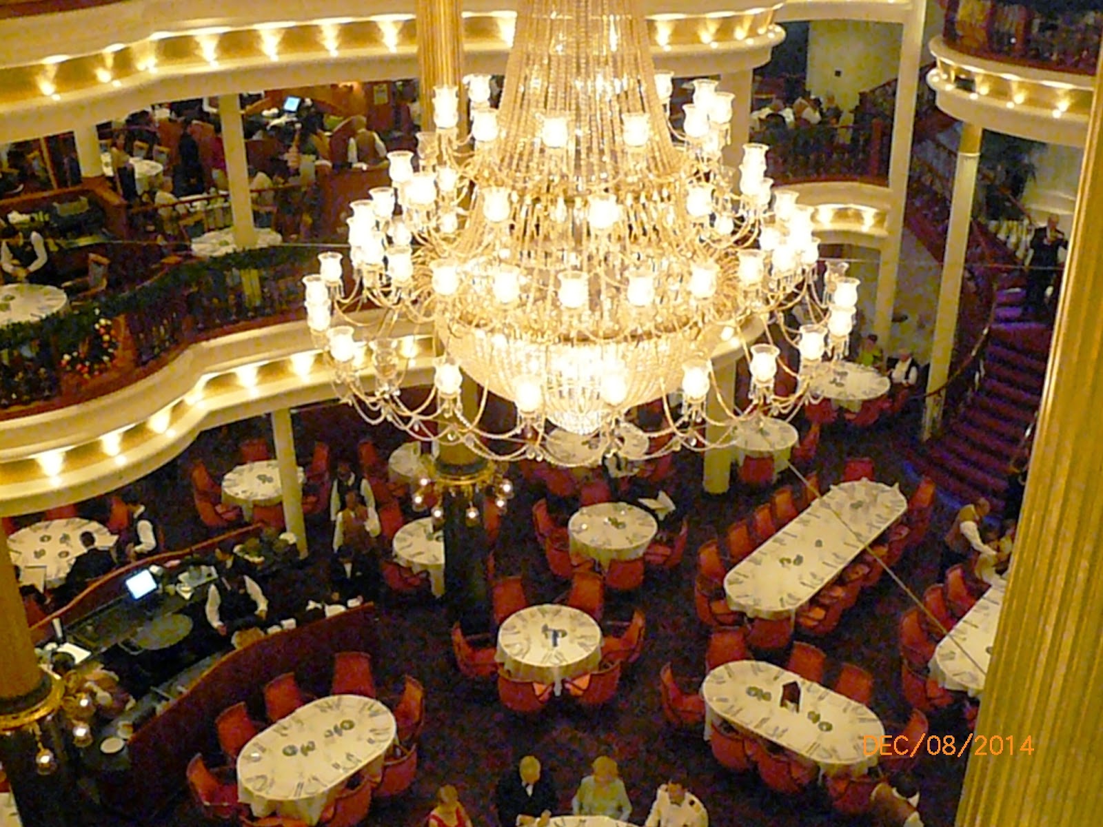
Here we have a picture of our state room from the balcony. The rooms are a little small but very well kept and clean. The service here is phenomenal as they come in 2 times a day to clean and keep things tidy. Each night after 6 pm they leave a list of the activities that are going on around the ship for the next day and believe me there is no shortage of activities and shopping on this ship.


                                                                                As we leave the port we managed to get some pics of the coastline of Cape Canaveral and while heading out to sea the sunset was spectacular. When you are standing on the top deck of this ship you can see miles and miles.  

   Image result for labadee haiti


On the third day of our cruise we arrived in Labadee, Labadee is a port located on the northern coast of Haiti. It is a private resort leased to Royal Caribbean International until 2050  Royal Caribbean International has contributed the largest proportion of tourist revenue to Haiti since 1986, employing 300 locals, allowing another 200 to sell their wares on the premises for a fee and paying the Haitian government US$6 per tourist.
The resort is completely tourist-oriented, and is guarded by a private security force. The site is fenced off from the surrounding area, and passengers are not allowed to leave the property. Food available to tourists is brought from the cruise ships. A controlled group of Haitian merchants are given sole rights to sell their merchandise and establish their businesses in the resort. Although sometimes described as an island in advertisements, it is actually a peninsula contiguous with the island of Hispaniola. The cruise ship moors to the pier at Labadee capable of servicing the Oasis class ships, which was completed in late 2009.
Attractions include a Haitian flea market, beaches, watersports, a water-oriented playground, a roller-coaster-type ride, and a zip-line. The zip line is the largest in the world over open water.                       


There are 2 formal nights where you have to get dressed up to go to dinner. Here we have a picture of us just before going to dinner on the first formal night. This pic was taken on the balcony of our state room with the Atlantic ocean as the backdrop.
The dining rooms are located on three levels and open in the middle overlooking the Captains table. The tables are made up very elegantly and the food was also elegant.


On the fourth day of our cruise we arrived in Falmouth. Falmouth is the chief town and capital of the parish of Trelawny in Jamaica. It is situated on Jamaica's north coast 18 miles east of Montego Bay. It is noted for being one of the Caribbean's best-preserved Georgian town. Falmouth flourished as a market centre and port for forty years at a time when Jamaica was the world's leading sugar producer.
The town was meticulously planned from the start, with wide streets in a regular grid, adequate water supply, and public buildings. It even had piped water before New York City.  Falmouth was one of the busiest ports in Jamaica. It was home to masons, carpenters, tavern-keepers, mariners, planters and others. It was a wealthy town in a wealthy parish with a rich racial mix. Within the parish, nearly one hundred plantations were actively manufacturing sugar and rum for export to Britain. Jamaica, during this period, had become the world's leading sugar producer.
All the above made Falmouth a central hub of the slave trade and the now notorious cross-Atlantic triangular trade, with its economy largely based on slavery. In Falmouth Harbour as many as 30 tall-ships could be seen on any given day, many of them delivering slaves transported under inhumane conditions from Africa and loading their holds with rum and sugar manufactured by slave labour on nearby plantations.
As a result, starting in 1840, Falmouth's fortunes as a commercial centre declined after the emancipation of slaves in the British Empire. This decline and lack of support for development has left many of its early buildings standing.


While in Jamaica we were fortunate enough to be able to take in some of the local beauty that this Island has to offer. They have a very large variety of beautiful and exotic birds also a vast array of marine life. We got to see a dolphin show and watched the sharks being fed.


On the fifth day our next port of call was in Georgetown,
George Town is a city situated on the Grand Cayman island of the Cayman Islands. It serves as the capital of the Cayman Islands, in the British West Indies. As of 2007, the city had a population of 28,836, making it the second largest city (by population) of all the British Overseas Territories.


George Town is the heart of the Cayman Islands financial industry, there are close to 600 Bank and Trust companies in the Cayman Islands. George Town's city limits extend from the east at the edge of the South Shore District, north just beyond Owen Roberts International Airport, south to Hog Sty Bay and west to Seven Mile Beach and the West Bay District. George Town's famous Seven Mile Beach is a long crescent of coral-sand beach extending up to the West Bay region of Grand Cayman and is the most popular and populated area for tourists on the island.


In Georgetown, they do not have a port to dock any of the cruise liners so the ships dock in the bay. All passengers are ferried back and  fourth into town by smaller boats. At times you can see as many as 5 cruise ships docked in the bay and just imagine getting over 20,000 passengers into town and then back on the ships again every time these ships pull into the harbor.


Our fourth port was suppose to be Cozumel, Mexico but after we left the Cayman Islands there was a medical emergency of a 9 month old baby girl and the ship and to be returned to Georgetown where the little girl was hospitalized and then flown to Miami. The ships also had some mechanical issues so the ship was running at reduced speed so the time could not be made up in order to get to the island of Cozumel. But on our way back to Port Canaveral we did catch a glimpse of Miami at sunset and it was beautiful.


Thursday, November 6, 2014

Kennedy Space Centre, Cape Canaveral, FL

We spent the day touring the Kennedy Space Centre in Cape Canaveral. This is where history is being made. This is where mankind first stepped off the face of the earth to explore the heavens. This is where the future of space exploration launches. And this is where you can experience the wonders of the space.


 Upon entering the complex you see the Rocket Garden. It is a display of historic rockets that put astronauts and satellites in space.

 
NASA's most incredible feat of engineering to date, a vehicle that launched like a rocket, flew in orbit like a spacecraft and landed on a runway like a glide plane. After 33 successful missions to space and back Space Shuttle Atlantis is the newest star at the Kennedy Space Centre. You stand feet away from Atlantis and experience all the awe and wonder that surrounds this amazing spacecraft. It is an experience that truly is awe inspiring and unforgettable.


These are replicas of the booster rockets that propelled Atlantis into space.


We took a bus tour to the restricted areas of Kennedy Space Centre. We got to experience the space program's past and future space exploration. We toured various launch pads, the exterior of the Vehicle Assembly Building (VAB) and the Shuttle Landing Facility as well we  drove the NASA causeway to see a view of rocket launch sites at Cape Canaveral Air Force Station. 
The crawler-transporters are a pair of tracked vehicles used to transport spacecraft from NASA's Vehicle Assembly Building (VAB) along the Crawlerway to Launch Complex 39. They were originally used to transport the Saturn IB and Saturn V rockets during the Apollo, Skylab and Apollo–Soyuz programs. They were then used to transport Space Shuttles from 1981 to 2011. The two crawler-transporters cost  $14 million each (US). Upon its construction, the crawler-transporter became the largest self-powered land vehicle in the world.
Crawler-Transporter.jpg


We got to step inside Firing Room 4 of the Launch Control Centre to see and experience where engineers monitored system checks leading up to a launch.


We also visited the Apollo/Saturn V Centre. This is where it all began. On, July 20, 1969, millions of people all over the world held their breath while a single man put his foot on the moon's surface. We saw actual moon rocks and lunar suits. We were blown away to see the largest rocket ever flown, the mighty Saturn V.  This monumental 363 feet rocket was America's lunar transportation for 24 brave astronauts who travelled to the moon and back.


 Apollo 14 Space Capsule. Apollo 14 was the eighth manned mission in the United States Apollo program, and the third to land on the Moon. Alan Shepard, Command Module Pilot, Stuart Roosa, and Lunar Module Pilot Edgar Mitchell launched on their nine-day mission on Jan. 31, 1971. Shepard and Mitchell made their lunar landing on February 5 in the Fra Mauro formation; this had originally been the target of the aborted Apollo 13 mission. During the two lunar EVAs, 93 lbs. of Moon rocks were collected. 
Apollo 14 Shepard.jpg


Alan Shepard plants an American flag on the Moon during Apollo 14. Shepard famously hit two golf balls on the lunar surface with a makeshift club he had brought from Earth.


Thursday, October 30, 2014

Sanibel Island, FL

We were told that one of the must places you have to visit in South Western Florida is Sanibel Island. Located on the Gulf of Mexico just a short drive from Ft. Myers lies this picturesque Island. Sanibel beaches attract visitors from all around the world, partly because of the large quantities of seashells that frequently wash up there. One of the reasons for these large accumulations of shells is the fact that Sanibel is a barrier island which is "part of a large plateau that extends out into the Gulf of Mexico for miles. It is this plateau that acts like a shelf for seashells to gather." Sanibel also has an "east-west orientation when most islands are north-south. Hence, the island is gifted with great sandy beaches and an abundance of shells.
   
 
In order to get to Sanibel from Ft. Myers you have to take the Sanibel Causeway which spans the San Carlos Bay, connecting Sanibel Island with the Florida mainland. The causeway consists of three separate two-lane bridge spans, and two man-made causeway islands between them. The entire causeway is three miles long from end to end, and currently has a six dollar toll in effect for island-bound vehicles only.


Arriving on Sanibel Island from the causeway.


Sanibel Island has a climate that is subtropical and humid, and produces a very lush and diverse landscape with several different types of palm trees.  During our entire stay in this area, the temperatures reached a consistent 85 - 90 degrees  (30 celcius) and the evenings did not cool down and stayed just as warm. It was beautiful sunny warm weather in such a tropical place.
More than half of the island is made up of wildlife refuges.
 

We arrived at one the beaches on the island  and were eager to see what kind of sea shells we might find. The best time to go shelling is at low tide. Yes there were shells everywhere along the shoreline. And of course if you get into the water from your knees to your hips, like everyone else was doing you could find even more special shells hiding ontop of the sands below. People were in the water with their nets scooping up sea shells and also just walking up and down the shorelines with their nets and special gadgets to find the seashells. There were alot of serious shell collectors on-site each comparing with each other their finds of the day.     


We found alot of very beautiful colorful sea shells. This is just a small assortment of  the type of sea shells that were found there.


We found a Live Sea Urchin that had nestled itself inside of a semi opened large clam shell. The clam shell had washed up on the beach and I retrieved the sea urchin out. As the sea urchin was still alive I threw it back into the ocean. 
Well it was no ordinary day at the Sanibel Island Golf Club. We pulled up to the 8th tee box and saw what looked like to be an alligator chewing on something. He was tossing around a iguana and then eating it. One of the fellows that we were golfing with hit his ball and it landed about 5 feet from the gator. When we got up there the gator had finished eating his prey and was just sunning. He then saw us taking pictures and started returning to the lagoon which he came from. He was estimated to be about 11 feet long, not a animal you want to get close to or mess with thats for sure.

A picture from the Sanibel Golf course that shows the nice palm trees that line the course.

St. Augustine, FL

We made it to Florida.  The Sunshine State...WOW!!!

You can sure tell that you are in a tropical climate the landscape is lush and beautiful. We are still driving through these big old beautiful oak trees with spanish moss (an air plant) hanging from them. They sure are cool.


St. Augustine (Spanish: San Agustín) is a city in Northeast Florida and the oldest continuously occupied European-established settlement and port in the continental United States.  It was pretty surprising going to the ocean/beaches here today, here you just drive on the beach pick your spot and park, right beside the ocean. The beach is your parking lot.
 
We also were surprised how hard the sand actually was. It was compressed down and it was smooth. Almost like a smooth paved road.


The weather has been very nice, around 82 degrees. It was a beautiful day so we spent a few hours enjoying riding our bicycles at the shore line beside the ocean. It was so much fun. We had a nice breeze from the ocean and really enjoyed the ride. The ocean water was warm. We stopped along the way to pick up sea shells that caught our attention.
 
We brought the tri-pod for the camera and sure had alot of fun setting up the auto-timer and posing for the camera.  We were laughing so hard.


We counted 10 fishing boats not far from the shoreline trolling for shrimp.

Tuesday, October 21, 2014

Charleston, SC


Ahhhh! Charleston, South Carolina, What can one say about this beautiful, stately city. Known for its rich history, well-preserved architecture, distinguished restaurants, warm subtropical climate and mannerly people, Charleston has received a large number of accolades, including "America's Most Friendly [City]" by Travel + Leisure in 2011 and in 2013 and 2014 by Condé Nast Traveler."


Charleston is the oldest and second-largest city in the southeastern State of South Carolina. The city lies just south of the geographical midpoint of South Carolina's coastline and is located on Charleston Harbor, an inlet of the Atlantic Ocean formed by the confluence of the Ashley and Cooper rivers.


Upon our arrival to Charleston we traveled over this bridge to downtown. The Arthur Ravenel Jr. Bridge, also known as the New Cooper River Bridge, is a cable-stayed bridge over the Cooper River in South Carolina, connecting downtown Charleston to Mount Pleasant. The eight lane bridge, when it opened in 2005 replaced two obsolete cantilever truss bridges. The bridge has a main span of 1,546 feet (471 m), the third longest among cable-stayed bridges in the Western Hemisphere. It was built using the design-build method and was designed by Parsons Brinckerhoff.
200440398001


The Spanish moss on the Oak Trees was a magical experience. It gave you a grandeur setting, filled with romantic old world charm. It reminded us that yes indeed we are definitely in the deep South.


And yes there is more charm, cobblestone streets...


Charleston is known as The Holy Cityby virtue of the prominence of the many churches on the low-rise cityscape. 


The day started with us walking through historic Charleston. The weather was 80 degrees and absolutely beautiful  The stately homes, the wonderfully rich architecture and the lush manicured gardens was simply breathtaking. The historical homes and buildings were amazing and beautiful to see. We sure went back in time and experienced a special kind of history, this southern city is truly spectacular and one of a kind.

We also took a narrated horse and carriage ride through the streets of historic Charleston and we marvelled at all this beauty and took in a lot of history. We learned a lot from our guide who was an amazing multi-tasking kind of guy; talking to us all and teaching us a history lesson for 1 hour, all while maneuvering the horse and carriage with 12 passengers up and down many, many streets, and maneuvering in and out of traffic. It was all unbelievable, it was truly a very magical day.


The USS YORKTOWN (CV-10) was the tenth aircraft carrier to serve in the United States Navy.

Under construction as BON HOMME RICHARD, this new Essex-class carrier was renamed YORKTOWN in honor of YORKTOWN (CV-5), sunk at the epic Battle of Midway (June 1942). Built in an amazing 16-½ months at Newport News, Virginia, YORKTOWN was commissioned on April 15, 1943, and participated significantly in the Pacific Offensive that began in late 1943 and ended with the defeat of Japan in 1945. YORKTOWN received the Presidential Unit Citation, and earned 11 battle stars for service in World War II. Much of the Academy Award-winning (1944) documentary "The Fighting Lady" was filmed on board YORKTOWN.

This is a picture of what Fort Sumter looked like before the wars that it endured over many years. Fort Sumter is a Third System masonry sea fort located in Charleston Harbor, South Carolina. The fort is best known as the site upon which the shots that started the American Civil War were fired, at the Battle of Fort Sumter on April 12, 1861. In 1966, the site was listed on the National Register of Historic Places.
 

When the Civil War ended, Fort Sumter was in ruins. The U.S. Army worked to restore it as a useful military installation. The damaged walls were re-leveled to a lower height and partially rebuilt. The third tier of gun emplacements was removed. Eleven of the original first-tier gun rooms were restored with 100-pounder Parrott rifles.
From 1876 to 1897, Fort Sumter was used only as an unmanned lighthouse station. The start of the Spanish-American War prompted renewed interest in its military use and reconstruction commenced on the facilities that had further eroded over time. A new massive concrete blockhouse-style installation was built in 1898 inside the original walls. Named "Battery Huger" in honor of Revolutionary War General Isaac Huger, it never saw combat.