Thursday, October 30, 2014

Sanibel Island, FL

We were told that one of the must places you have to visit in South Western Florida is Sanibel Island. Located on the Gulf of Mexico just a short drive from Ft. Myers lies this picturesque Island. Sanibel beaches attract visitors from all around the world, partly because of the large quantities of seashells that frequently wash up there. One of the reasons for these large accumulations of shells is the fact that Sanibel is a barrier island which is "part of a large plateau that extends out into the Gulf of Mexico for miles. It is this plateau that acts like a shelf for seashells to gather." Sanibel also has an "east-west orientation when most islands are north-south. Hence, the island is gifted with great sandy beaches and an abundance of shells.
   
 
In order to get to Sanibel from Ft. Myers you have to take the Sanibel Causeway which spans the San Carlos Bay, connecting Sanibel Island with the Florida mainland. The causeway consists of three separate two-lane bridge spans, and two man-made causeway islands between them. The entire causeway is three miles long from end to end, and currently has a six dollar toll in effect for island-bound vehicles only.


Arriving on Sanibel Island from the causeway.


Sanibel Island has a climate that is subtropical and humid, and produces a very lush and diverse landscape with several different types of palm trees.  During our entire stay in this area, the temperatures reached a consistent 85 - 90 degrees  (30 celcius) and the evenings did not cool down and stayed just as warm. It was beautiful sunny warm weather in such a tropical place.
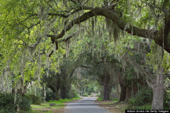
More than half of the island is made up of wildlife refuges.
 

We arrived at one the beaches on the island  and were eager to see what kind of sea shells we might find. The best time to go shelling is at low tide. Yes there were shells everywhere along the shoreline. And of course if you get into the water from your knees to your hips, like everyone else was doing you could find even more special shells hiding ontop of the sands below. People were in the water with their nets scooping up sea shells and also just walking up and down the shorelines with their nets and special gadgets to find the seashells. There were alot of serious shell collectors on-site each comparing with each other their finds of the day.     


We found alot of very beautiful colorful sea shells. This is just a small assortment of  the type of sea shells that were found there.


We found a Live Sea Urchin that had nestled itself inside of a semi opened large clam shell. The clam shell had washed up on the beach and I retrieved the sea urchin out. As the sea urchin was still alive I threw it back into the ocean. 
Well it was no ordinary day at the Sanibel Island Golf Club. We pulled up to the 8th tee box and saw what looked like to be an alligator chewing on something. He was tossing around a iguana and then eating it. One of the fellows that we were golfing with hit his ball and it landed about 5 feet from the gator. When we got up there the gator had finished eating his prey and was just sunning. He then saw us taking pictures and started returning to the lagoon which he came from. He was estimated to be about 11 feet long, not a animal you want to get close to or mess with thats for sure.

A picture from the Sanibel Golf course that shows the nice palm trees that line the course.

St. Augustine, FL

We made it to Florida.  The Sunshine State...WOW!!!

You can sure tell that you are in a tropical climate the landscape is lush and beautiful. We are still driving through these big old beautiful oak trees with spanish moss (an air plant) hanging from them. They sure are cool.


St. Augustine (Spanish: San Agustín) is a city in Northeast Florida and the oldest continuously occupied European-established settlement and port in the continental United States.  It was pretty surprising going to the ocean/beaches here today, here you just drive on the beach pick your spot and park, right beside the ocean. The beach is your parking lot.
 
We also were surprised how hard the sand actually was. It was compressed down and it was smooth. Almost like a smooth paved road.


The weather has been very nice, around 82 degrees. It was a beautiful day so we spent a few hours enjoying riding our bicycles at the shore line beside the ocean. It was so much fun. We had a nice breeze from the ocean and really enjoyed the ride. The ocean water was warm. We stopped along the way to pick up sea shells that caught our attention.
 
We brought the tri-pod for the camera and sure had alot of fun setting up the auto-timer and posing for the camera.  We were laughing so hard.


We counted 10 fishing boats not far from the shoreline trolling for shrimp.

Tuesday, October 21, 2014

Charleston, SC


Ahhhh! Charleston, South Carolina, What can one say about this beautiful, stately city. Known for its rich history, well-preserved architecture, distinguished restaurants, warm subtropical climate and mannerly people, Charleston has received a large number of accolades, including "America's Most Friendly [City]" by Travel + Leisure in 2011 and in 2013 and 2014 by Condé Nast Traveler."


Charleston is the oldest and second-largest city in the southeastern State of South Carolina. The city lies just south of the geographical midpoint of South Carolina's coastline and is located on Charleston Harbor, an inlet of the Atlantic Ocean formed by the confluence of the Ashley and Cooper rivers.


Upon our arrival to Charleston we traveled over this bridge to downtown. The Arthur Ravenel Jr. Bridge, also known as the New Cooper River Bridge, is a cable-stayed bridge over the Cooper River in South Carolina, connecting downtown Charleston to Mount Pleasant. The eight lane bridge, when it opened in 2005 replaced two obsolete cantilever truss bridges. The bridge has a main span of 1,546 feet (471 m), the third longest among cable-stayed bridges in the Western Hemisphere. It was built using the design-build method and was designed by Parsons Brinckerhoff.
200440398001


The Spanish moss on the Oak Trees was a magical experience. It gave you a grandeur setting, filled with romantic old world charm. It reminded us that yes indeed we are definitely in the deep South.


And yes there is more charm, cobblestone streets...


Charleston is known as The Holy Cityby virtue of the prominence of the many churches on the low-rise cityscape. 


The day started with us walking through historic Charleston. The weather was 80 degrees and absolutely beautiful  The stately homes, the wonderfully rich architecture and the lush manicured gardens was simply breathtaking. The historical homes and buildings were amazing and beautiful to see. We sure went back in time and experienced a special kind of history, this southern city is truly spectacular and one of a kind.

We also took a narrated horse and carriage ride through the streets of historic Charleston and we marvelled at all this beauty and took in a lot of history. We learned a lot from our guide who was an amazing multi-tasking kind of guy; talking to us all and teaching us a history lesson for 1 hour, all while maneuvering the horse and carriage with 12 passengers up and down many, many streets, and maneuvering in and out of traffic. It was all unbelievable, it was truly a very magical day.


The USS YORKTOWN (CV-10) was the tenth aircraft carrier to serve in the United States Navy.

Under construction as BON HOMME RICHARD, this new Essex-class carrier was renamed YORKTOWN in honor of YORKTOWN (CV-5), sunk at the epic Battle of Midway (June 1942). Built in an amazing 16-½ months at Newport News, Virginia, YORKTOWN was commissioned on April 15, 1943, and participated significantly in the Pacific Offensive that began in late 1943 and ended with the defeat of Japan in 1945. YORKTOWN received the Presidential Unit Citation, and earned 11 battle stars for service in World War II. Much of the Academy Award-winning (1944) documentary "The Fighting Lady" was filmed on board YORKTOWN.

This is a picture of what Fort Sumter looked like before the wars that it endured over many years. Fort Sumter is a Third System masonry sea fort located in Charleston Harbor, South Carolina. The fort is best known as the site upon which the shots that started the American Civil War were fired, at the Battle of Fort Sumter on April 12, 1861. In 1966, the site was listed on the National Register of Historic Places.
 

When the Civil War ended, Fort Sumter was in ruins. The U.S. Army worked to restore it as a useful military installation. The damaged walls were re-leveled to a lower height and partially rebuilt. The third tier of gun emplacements was removed. Eleven of the original first-tier gun rooms were restored with 100-pounder Parrott rifles.
From 1876 to 1897, Fort Sumter was used only as an unmanned lighthouse station. The start of the Spanish-American War prompted renewed interest in its military use and reconstruction commenced on the facilities that had further eroded over time. A new massive concrete blockhouse-style installation was built in 1898 inside the original walls. Named "Battery Huger" in honor of Revolutionary War General Isaac Huger, it never saw combat.

Sunday, October 19, 2014

Myrtle Beach, SC


Myrtle Beach is a coastal city situated on the center of a large and continuous stretch of beach known as the Grand Strand in northeastern South Carolina. The Grand Strand refers to a large stretch of beaches and it consists of 60+ miles along an essentially uninterrupted arc of beach land, beginning at Little River and ending at  Georgetown. Myrtle Beach is a major center of tourism because of the city's warm subtropical climate and extensive beaches, attracting over 14 million visitors annually. The Grand Strand offers more than 1,600 restaurants with many all you can eat buffets. There shopping is endless with 2 large outlet malls within 10 miles of each other along with several other shopping malls. There are over 100 golf courses located in a 60 mile stretch of the coastline known as the Grand Strand.
It really was crazy to see this all, and it reminded us of Las Vegas and Palm Springs mixed together = Myrtle Beach.


The Myrtle Beach Boardwalk officially opened in May 2010 at a cost of nearly $6.4 million and runs 1.2 miles (1.9 km) along the oceanfront. National Geographic has ranked Myrtle Beach Boardwalk number three in the United States, while Travel and Leisure ranked the boardwalk number two. 

The Myrtle Beach Sky Wheel is a 187 foot tall Ferris wheel with feature glass gondolas that look over the Atlantic Ocean. The SkyWheel has "42 glass-enclosed, temperature controlled gondolas". The wheel operates year-round. Though the wheel itself can withstand 135 MPH winds, the gondolas must be removed if high winds are predicted, a process that takes 8 to 10 hours.


Our campground; Myrtle Beach State Park, was established in 1935, and has just under a mile of Grand Strand beach and is a prime location for swimming, hiking, biking, and fishing. We are away from the hustle and bustle of the city and the park has lovely treed camp sites that are 5 minute walk to a beautiful private beach.


  The Myrtle Beach State Park also has it's own pier. People come from all over the area to fish the pier, or enjoy the beach. We went onto the pier and talked to a few people and were told that their are 8 ft long sharks all along the pier as they are attracted to the fish. We have also been told we came to visit this area at the right time of the year, as they are now entering their low season and a lot of restaurants and businesses are closing down for the winter. In the summer time it is completely crazy and busy with tourists.  We were very happy to hear that this is the ideal time to come and visit Myrtle Beach as it is much quieter this time a year with far less tourists.
 
The weather here has been absolutely beautiful. Temperatures have been hovering in the high 70's to the low 80's. We went for a walk on the beach at sunset and it was beautiful.   


Friday, October 17, 2014

Carolina Beach, NC

A few miles away from Carolina Beach is Kure Pier and what a terrific historic pier to visit. Laid back and relaxed. You walk into the pier store to access the pier and it is full of all the fishing equipment that you will need. The Pier fishing is only $5 a person, they don't charge to park your car, if you just want to take a walk on the pier there is no charge for that either.
Opens April 1st through November 30th : One Rod and Reel per Person $5.00 per Fisherman
King Fishing - $12 * May 15th - October 1st * 3 Rods * 6am to Sunset
Shark Fishing -  $12 * June 1st - Sept. 15th * 3 Rods * 12 am to 6am
  
 P1010180


While we were there a fisherman pulled up this small stingray.

A lady was cleaning her catch of "Spots" that were in season for this time of year.

Thursday, October 16, 2014

Leaving Outer Banks, NC

Leaving Avon, NC in the Outer Banks to get to our next destination which was Carolina Beach, NC we used two ferries to get us off of the Outer Banks. The first ferry took us from Cape Hatteras to Ocracoke Island. This is the ferry with our trailer parked on it as we left the Hatteras harbour. This was at seven o'clock in the morning, we had be on this ferry to get to the next ferry that leaves Ocracoke Island to Cedar Island which departs at 10 am.
 The Hatteras / Ocracoke ferry is one of the most popular of the seven coastal ferry routes that are orchestrated and managed by the North Carolina Department of Transportation (NCDOT.) Open for everyone, with daily runs that occur 365 days a year, it is a free ferry even for trucks and trailers and takes anywhere from  45 minute to an hour and provides an integral link for Ocracoke Island to the rest of the Outer Banks.


Just as we were arriving at Ocracoke Island we caught a glimpse of the sun rising over the Pamlico Sound.
The next ferry that we caught was from Ocracoke Island to Cedar Island. This was a 2 hr and 15 min ferry ride and we were able to take our truck and trailer for less than $50. In all our travels we have never taken a 2 hr ferry ride from one island to another with our trailer and truck for that kind of price and may never again. The ferry itself crosses the Pamlico Sound in North Carolina, it is the largest lagoon along the U.S. East Coast, being 129 km (80 mi) long and 24 to 48 km (15 to 30 miles) wide. It is a body of water separated from the Atlantic Ocean by the Outer Banks, a row of low, sandy barrier islands, including Cape Hatteras.
 The Pamlico sound and its ocean inlets are noted for wide expanses of shallow water and occasional shoaling, making the area hazardous for larger vessels. In addition, the shallow waters are susceptible to wind and barometric pressure-driven tidal fluctuations. Pamlico Sound is part of a large, interconnected network of lagoon estuaries. As a whole it is the second largest estuary in the United States (Chesapeake Bay is the largest).