Thursday, September 11, 2014

Lunenburg, NS


Picturesque Lunenburg lies nestled along the scenic shores of southern Nova Scotia, Lunenburg is located on the Fairhaven Peninsula at the western side of Mahone Bay and is  one hour from Halifax international airport. You just know you’re somewhere very special.  This place is a beauty with its glistening harbour, bright paint, and magnificent buildings. Lunenburg is a world-class fishing and shipbuilding port founded in 1753. Lunenburg is now a UNESCO World Heritage Site designation, the designation by UNESCO is based upon Lunenburg’s status as the best preserved North American example of a eighteenth century British colonial town plan. It is home to Bluenose II and birthplace of the original Bluenose.


The BLUENOSE was built in the Smith and Rhuland Shipyard in Lunenburg and launched March 26, 1921. For the next 17 years the Bluenose defeated all contenders and during this period Bluenose earned her keep and was high-liner of the Lunenburg fishing fleet on a number of occasions. In 1938, Bluenose was named the Queen of the North Atlantic. In 1942 the vessel was sold to the West Indian Trading Company and for four years carried freight in the Caribbean. On January 28, 1946, the Bluenose struck a Haitian reef and sank. BLUENOSE II was launched in the same shipyard of Smith and Rhuland and by some of the same men and launched July 24, 1963 in its home port of Lunenburg. Identical to  Bluenose in design of  hull, rigging and sail plan. Bluenose II was sold to the government of Nova Scotia for $1 in 1971 by the Oland family of Halifax, and represents Nova Scotia as a sailing good will ambassador. Bluenose II is acknowledged to  have the largest working mainsail in the world, measuring 4,150 square feet. Total sail area measures over 11,000 square feet. The masts, booms, gaffs and  deck are made of Douglas Fir. The deck hatches, skylights and structures are made of mahogany, and the hull is angelique. The top speed logged under sail is 16 knots. The image of the Bluenose has graced the Canadian dime since 1937. The Bluenose II was rebuilt in 2012 and is almost complete its rebuilt.


These starfish were caught right at the Lunenburg harbour and placed in an aquarium and will be released back into the harbour at the end of this month. Starfish like to feed on mussels.
 
Lunenburg Academy construction began in the fall of 1894 and proceeded smoothly until early 1895 when the Oxford Furniture Company went bankrupt. At that point, work was continued under the direction of Solomon Morash, a local master builder. The final cost of the building was $30,000.00. It was opened on November 7, 1895. The Lunenburg Academy is the only intact 19th century Academy building surviving in Nova Scotia. The Academy is entirely a wood frame structure. It is 96 x 125 feet in dimension and stands three stories high with a mansard roof.


Monday, September 8, 2014

Shelburne, NS

 Shelburne lies at the southwest corner of Nova Scotia, at roughly the same latitude as Portland, Maine.
Shelburne was incorporated as a town on April 4, 1907.
Fishing is a primary industry, along with economic activities including tourism, ship building and repair, aquaculture, logging, and fish processing.


This is the view from our campground which overlooks the Shelburne waterfront. The buildings are all made of wood and add such character to this quaint fishing village.


Saturday, September 6, 2014

Long Island, Brier Island and Digby, NS

 
Between the rip tides of Petite Passage and Grand Passage lies Long Island, featuring rugged coastlines and striking basalt formations. The five minute ferry ride from Digby Neck lands you in Tiverton, where the Island Museum is located. A few kilometers down the road is the trailhead to the world-famous "Balancing Rock," a spectacular columnar basaltic sea stack. On the southwestern end of the island you will find the community of Freeport, with a beautiful harbour and a large fleet of lobster and fishing boats.


Brier Island is a rugged diamond in Nova Scotia's crown, an amazing variety of flora and fauna. The westernmost point in the province, this small basalt island sits where the cold waters of the Gulf of Maine and the Bay of Fundy meet.

 
The Town of Digby is situated on the western shore of the Annapolis Basin near the entrance to Digby Gut which connects the basin to the Bay of Fundy. It is an active fishing community, and is famous for the delicious scallops harvested from the local waters. With the waterfront location on the shores of the Annapolis Basin, the area offers spectacular viewing of the incredible tides (27ft. to 32 ft.) in the harbour.  Digby is a sister community to Saint John, New Brunswick.  A ferry service has joined these two locations on opposite sides of the Bay of Fundy for over 200 consecutive years.


Friday, September 5, 2014

Fishing Villages, Harbourville & Hall's Harbour


Harbourville, the best kept secret on the Bay of Fundy, considered by many to be the crowning jewel among the working fishing villages on this side of the Bay. Its natural harbour provides sanctuary to a fleet of colourful boats and is home port to generations of fishermen and their families. A photographer's 'el dorado', visitors and tourists alike marvel at the breathtaking opening scene coming into Harbourville from high above on Highway 360. Rows and rows of lupines and quaint well kept homes and cottages are the gateway to a picturesque postcard harbour scene of unmatched beauty.
Hall's Harbour is a picturesque fishing community located along the shore of the Bay of Fundy. It lends its name both to the small fishing hamlet and to the wider community which takes up an area roughly 5 kilometers square. On the south, the area overlooks the Annapolis Valley, on the north overlooks the Bay of Fundy, on the east Sheffield Vault and on the west Chipman Brook. The area is very scenic and the hamlet itself has been declared a Nova Scotia Tourism Destination Area. The village is reputedly named after Samuel Hall, an American privateer in the American Revolution. Hall used the cove to raid settlements in the Annapolis Valley but was forced to flee and abandon his ship in the harbour by pursuing militia in 1779. Hall's Harbour was first settled in 1826 with the first wharf built in 1836. In later years, legend held that Hall left treasure behind, attracting treasure hunters who have left abandoned pits deep in the woods surrounding the harbour.
When we arrived at Hall's Harbour the tide was at low tide. We could not believe the amount of water that goes in and out of this harbour in a 24 hour period. We estimated the water line shown in the harbour entrance to be in between 20 and 30 feet. It was simply unbelievable. You have to see it to believe it.
 
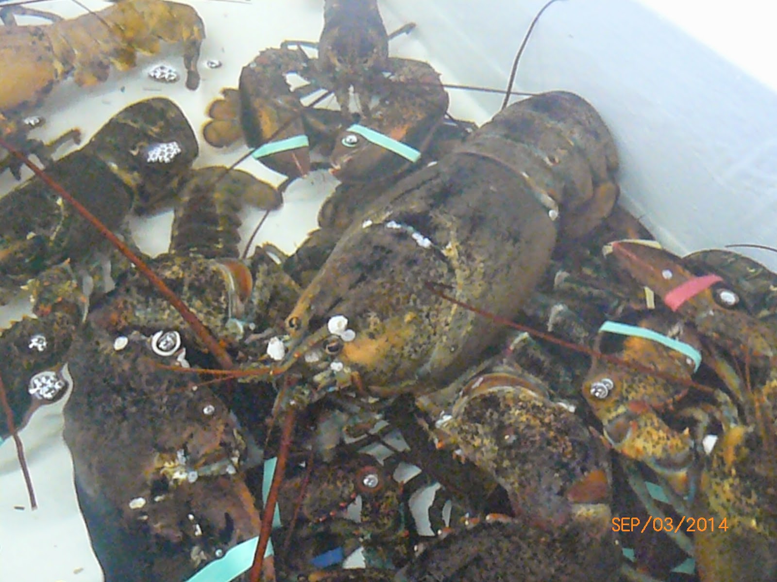
Nova Scotia is well know for its Lobsters. While we were in Parker's Cove we stopped at a Seafood Market and discovered the grand daddy of all lobsters.

Annapolis Valley, Bridgetown, NS

 
This is the view from our campsite at the Provincial campground we are staying at. The view overlooks the Annapolis Valley at Bridgetown, NS. The weather has been beautiful, mostly warm and sunny and temperatures have been reaching the mid 20's.


The beautiful view of the Annapolis valley where orchards of apples, peaches, and other varieties of fruits and vegetables grow. This area is also well developed in vineyards that also line the valley. The Annapolis Valley is a valley and region in the Canadian province of Nova Scotia. It is located in the western part of the Nova Scotia peninsula, formed by a trough between two parallel mountain ranges along the shore of the Bay of Fundy

Friday, August 29, 2014

Tall Ships, Charlottetown Harbor, Prince Edward Island


Confederation Bridge, Prince Edward Island

 
This is one of the most awesome sites that you can see in the Maritime Provinces, it is definitely a must see. The Confederation Bridge, the link between New Brunswick and Prince Edward Island over the Atlantic Ocean is the worlds longest bridge over ice covered water.
The bridge is 13 kilometers(8 mi) long and takes 12 min to cross at the posted speed. The bridge cost an estimated $840 million to build. As of June 1, 1997, The Federal Government is required to make 35 annual payments to Strait Crossing Development Inc. of $41.9 million. The developer will keep the revenue generated by bridge tolls until year 2032. According to terms or agreement with the Federal Government, Straight Crossing Bridge Ltd. will operate and maintain the Confederation Bridge. This agreement covers a period of 35 years (1997-2032) after which the Bridge becomes property of the Federal Government.
It took 6,000 employees four years to construct and employment consisted of a worldwide range of people that provided highly skilled job opportunities for Atlantic Canadian workers. The average height of the bridge is 40 meters above water and the highest point is at the shipping navigation span which reaches 60 meters above the water. This allows vessels such as cruise ships, tankers etc. to pass underneath. The bridge construction began October 7, 1993 and finished May 31, 1997. The grand opening for the public was June 1st 1997.