Tuesday, October 21, 2014

Charleston, SC


Ahhhh! Charleston, South Carolina, What can one say about this beautiful, stately city. Known for its rich history, well-preserved architecture, distinguished restaurants, warm subtropical climate and mannerly people, Charleston has received a large number of accolades, including "America's Most Friendly [City]" by Travel + Leisure in 2011 and in 2013 and 2014 by Condé Nast Traveler."


Charleston is the oldest and second-largest city in the southeastern State of South Carolina. The city lies just south of the geographical midpoint of South Carolina's coastline and is located on Charleston Harbor, an inlet of the Atlantic Ocean formed by the confluence of the Ashley and Cooper rivers.


Upon our arrival to Charleston we traveled over this bridge to downtown. The Arthur Ravenel Jr. Bridge, also known as the New Cooper River Bridge, is a cable-stayed bridge over the Cooper River in South Carolina, connecting downtown Charleston to Mount Pleasant. The eight lane bridge, when it opened in 2005 replaced two obsolete cantilever truss bridges. The bridge has a main span of 1,546 feet (471 m), the third longest among cable-stayed bridges in the Western Hemisphere. It was built using the design-build method and was designed by Parsons Brinckerhoff.
200440398001


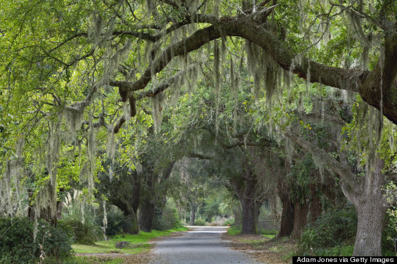
The Spanish moss on the Oak Trees was a magical experience. It gave you a grandeur setting, filled with romantic old world charm. It reminded us that yes indeed we are definitely in the deep South.


And yes there is more charm, cobblestone streets...


Charleston is known as The Holy Cityby virtue of the prominence of the many churches on the low-rise cityscape. 


The day started with us walking through historic Charleston. The weather was 80 degrees and absolutely beautiful  The stately homes, the wonderfully rich architecture and the lush manicured gardens was simply breathtaking. The historical homes and buildings were amazing and beautiful to see. We sure went back in time and experienced a special kind of history, this southern city is truly spectacular and one of a kind.

We also took a narrated horse and carriage ride through the streets of historic Charleston and we marvelled at all this beauty and took in a lot of history. We learned a lot from our guide who was an amazing multi-tasking kind of guy; talking to us all and teaching us a history lesson for 1 hour, all while maneuvering the horse and carriage with 12 passengers up and down many, many streets, and maneuvering in and out of traffic. It was all unbelievable, it was truly a very magical day.


The USS YORKTOWN (CV-10) was the tenth aircraft carrier to serve in the United States Navy.

Under construction as BON HOMME RICHARD, this new Essex-class carrier was renamed YORKTOWN in honor of YORKTOWN (CV-5), sunk at the epic Battle of Midway (June 1942). Built in an amazing 16-½ months at Newport News, Virginia, YORKTOWN was commissioned on April 15, 1943, and participated significantly in the Pacific Offensive that began in late 1943 and ended with the defeat of Japan in 1945. YORKTOWN received the Presidential Unit Citation, and earned 11 battle stars for service in World War II. Much of the Academy Award-winning (1944) documentary "The Fighting Lady" was filmed on board YORKTOWN.

This is a picture of what Fort Sumter looked like before the wars that it endured over many years. Fort Sumter is a Third System masonry sea fort located in Charleston Harbor, South Carolina. The fort is best known as the site upon which the shots that started the American Civil War were fired, at the Battle of Fort Sumter on April 12, 1861. In 1966, the site was listed on the National Register of Historic Places.
 

When the Civil War ended, Fort Sumter was in ruins. The U.S. Army worked to restore it as a useful military installation. The damaged walls were re-leveled to a lower height and partially rebuilt. The third tier of gun emplacements was removed. Eleven of the original first-tier gun rooms were restored with 100-pounder Parrott rifles.
From 1876 to 1897, Fort Sumter was used only as an unmanned lighthouse station. The start of the Spanish-American War prompted renewed interest in its military use and reconstruction commenced on the facilities that had further eroded over time. A new massive concrete blockhouse-style installation was built in 1898 inside the original walls. Named "Battery Huger" in honor of Revolutionary War General Isaac Huger, it never saw combat.

Sunday, October 19, 2014

Myrtle Beach, SC


Myrtle Beach is a coastal city situated on the center of a large and continuous stretch of beach known as the Grand Strand in northeastern South Carolina. The Grand Strand refers to a large stretch of beaches and it consists of 60+ miles along an essentially uninterrupted arc of beach land, beginning at Little River and ending at  Georgetown. Myrtle Beach is a major center of tourism because of the city's warm subtropical climate and extensive beaches, attracting over 14 million visitors annually. The Grand Strand offers more than 1,600 restaurants with many all you can eat buffets. There shopping is endless with 2 large outlet malls within 10 miles of each other along with several other shopping malls. There are over 100 golf courses located in a 60 mile stretch of the coastline known as the Grand Strand.
It really was crazy to see this all, and it reminded us of Las Vegas and Palm Springs mixed together = Myrtle Beach.


The Myrtle Beach Boardwalk officially opened in May 2010 at a cost of nearly $6.4 million and runs 1.2 miles (1.9 km) along the oceanfront. National Geographic has ranked Myrtle Beach Boardwalk number three in the United States, while Travel and Leisure ranked the boardwalk number two. 

The Myrtle Beach Sky Wheel is a 187 foot tall Ferris wheel with feature glass gondolas that look over the Atlantic Ocean. The SkyWheel has "42 glass-enclosed, temperature controlled gondolas". The wheel operates year-round. Though the wheel itself can withstand 135 MPH winds, the gondolas must be removed if high winds are predicted, a process that takes 8 to 10 hours.


Our campground; Myrtle Beach State Park, was established in 1935, and has just under a mile of Grand Strand beach and is a prime location for swimming, hiking, biking, and fishing. We are away from the hustle and bustle of the city and the park has lovely treed camp sites that are 5 minute walk to a beautiful private beach.


  The Myrtle Beach State Park also has it's own pier. People come from all over the area to fish the pier, or enjoy the beach. We went onto the pier and talked to a few people and were told that their are 8 ft long sharks all along the pier as they are attracted to the fish. We have also been told we came to visit this area at the right time of the year, as they are now entering their low season and a lot of restaurants and businesses are closing down for the winter. In the summer time it is completely crazy and busy with tourists.  We were very happy to hear that this is the ideal time to come and visit Myrtle Beach as it is much quieter this time a year with far less tourists.
 
The weather here has been absolutely beautiful. Temperatures have been hovering in the high 70's to the low 80's. We went for a walk on the beach at sunset and it was beautiful.   


Friday, October 17, 2014

Carolina Beach, NC

A few miles away from Carolina Beach is Kure Pier and what a terrific historic pier to visit. Laid back and relaxed. You walk into the pier store to access the pier and it is full of all the fishing equipment that you will need. The Pier fishing is only $5 a person, they don't charge to park your car, if you just want to take a walk on the pier there is no charge for that either.
Opens April 1st through November 30th : One Rod and Reel per Person $5.00 per Fisherman
King Fishing - $12 * May 15th - October 1st * 3 Rods * 6am to Sunset
Shark Fishing -  $12 * June 1st - Sept. 15th * 3 Rods * 12 am to 6am
  
 P1010180


While we were there a fisherman pulled up this small stingray.

A lady was cleaning her catch of "Spots" that were in season for this time of year.

Thursday, October 16, 2014

Leaving Outer Banks, NC

Leaving Avon, NC in the Outer Banks to get to our next destination which was Carolina Beach, NC we used two ferries to get us off of the Outer Banks. The first ferry took us from Cape Hatteras to Ocracoke Island. This is the ferry with our trailer parked on it as we left the Hatteras harbour. This was at seven o'clock in the morning, we had be on this ferry to get to the next ferry that leaves Ocracoke Island to Cedar Island which departs at 10 am.
 The Hatteras / Ocracoke ferry is one of the most popular of the seven coastal ferry routes that are orchestrated and managed by the North Carolina Department of Transportation (NCDOT.) Open for everyone, with daily runs that occur 365 days a year, it is a free ferry even for trucks and trailers and takes anywhere from  45 minute to an hour and provides an integral link for Ocracoke Island to the rest of the Outer Banks.


Just as we were arriving at Ocracoke Island we caught a glimpse of the sun rising over the Pamlico Sound.
The next ferry that we caught was from Ocracoke Island to Cedar Island. This was a 2 hr and 15 min ferry ride and we were able to take our truck and trailer for less than $50. In all our travels we have never taken a 2 hr ferry ride from one island to another with our trailer and truck for that kind of price and may never again. The ferry itself crosses the Pamlico Sound in North Carolina, it is the largest lagoon along the U.S. East Coast, being 129 km (80 mi) long and 24 to 48 km (15 to 30 miles) wide. It is a body of water separated from the Atlantic Ocean by the Outer Banks, a row of low, sandy barrier islands, including Cape Hatteras.
 The Pamlico sound and its ocean inlets are noted for wide expanses of shallow water and occasional shoaling, making the area hazardous for larger vessels. In addition, the shallow waters are susceptible to wind and barometric pressure-driven tidal fluctuations. Pamlico Sound is part of a large, interconnected network of lagoon estuaries. As a whole it is the second largest estuary in the United States (Chesapeake Bay is the largest). 

Sunday, October 12, 2014

The Outer Banks, NC


The Outer Banks is a 200-mile (320-km) long string of narrow barrier islands and peninsulas off the coast of North Carolina and a small portion of Virginia, beginning in the southeastern corner of Virginia Beach on the east coast. They cover most of the North Carolina coastline, separating the Currituck Sound, Albemarle Sound, and Pamlico Sound from the Atlantic Ocean. The Outer Banks peninsulas and barrier islands separate the Atlantic Ocean from mainland North Carolina. From north to south, the largest of these include: Bodie Island (which used to be an island but is now a peninsula due to tropical storms and hurricanes), Hatteras Island, and Ocracoke Island. The Outer Banks is not anchored to offshore coral reefs like some other barrier islands and as a consequence often suffers significant beach erosion during major storms. In fact, its location jutting out into the Atlantic makes it the most hurricane-prone area north of Florida, for both land falling storms and brushing storms offshore. Hatteras Island was cut in half on September 18, 2003, when Hurricane Isabel washed a 2,000 foot wide and 15 foot deep channel called Isabel Inlet through the community of Hatteras Village on the southern end of the island. The tear was subsequently repaired and restored by sand dredging by the U.S. Army Corps of Engineers. It was cut off once again in 2011 by Hurricane Irene and access to the island was largely limited to boat access only from August to late October until another temporary bridge could be built.


It was a sea of white from the sand dunes that were beside Hwy #12 just before our campground in Avon.
 
  
Atlantic currents in this area made for excellent travel for ships, except in the area of Diamond Shoals, just offshore at Cape Hatteras. The warm Gulf Stream ocean current collides with the colder Labrador Current, create ideal conditions for powerful ocean storms and sea swells. The large number of ships that ran aground because of these shifting sandbars, including the Civil War ironclad warship USS Monitor, gave this area the nickname “Graveyard of the Atlantic.” It led Congress to authorize the construction of the Cape Hatteras Light. Its 210 foot height makes it the tallest brick lighthouse structure in the United States and 29th in the world. Since its base is almost at sea level, it is only the 15th highest light in the United States.
Ever since the completion of the new tower in 1870, there had begun a gradual encroachment of the sea upon the beach. This did not become serious, until 1919, when the high water line had advanced to about 120 ft from the base of the tower. Since that time the surf gnawed steadily toward the base of the tower until 1935, when the site was finally reached by the surf. Therefore, in 1935, the tower light was replaced by a light on a skeleton steel tower placed farther back from the sea on a sand dune, 166 feet above the sea, and visible for 19 miles. The old tower was then abandoned to the custody of the National Park Service.  In 1999, the Cape Hatteras lighthouse had to be moved from its original location at the edge of the ocean to safer ground 1,500 feet inland. Due to erosion of the shore, the lighthouse was just 15 feet from the ocean’s edge and was in imminent danger. International Chimney Corp. of Buffalo, New York was awarded the contract to move the lighthouse, assisted, among other contractors, by Expert House Movers. The move was controversial at the time with speculation that the structure would not survive the move. Despite some opposition, work progressed and the move was completed on September 14, 1999. The Cape Hatteras Light House Station Relocation Project became known as “The Move of the Millennium.” The Cape Hatteras Lighthouse is the tallest masonry structure ever moved (200 feet tall and weighing 5,000 tons).


Spending some time at the beach was great, the temperature was 82 degrees and the gorgeous beaches go on for miles and miles with no one else around. It was peaceful and relaxing. And as a bonus the beach was only 10 minutes from our camp.

There are several beaches with designated areas specifically for permit holders; people purchase a permit and then are allowed to bring their vehicles onto beaches that allow permits and fish off the Atlantic shoreline. It is packed with fisherman and vehicles.
The Sands of Time Campground Office.


Thursday, October 9, 2014

Colonial Williamsburg, VA


Visiting Colonial Williamsburg was really a step back in time, as we toured around you felt almost like you were standing in the middle of a lot of history. Surviving colonial structures have been restored to estimates of 18th-century appearance, with traces of later buildings and improvements removed. Many of the missing Colonial structures were reconstructed on their original sites beginning in the 1930s.
Middle Plantation was renamed "Williamsburg" by Royal Governor Francis Nicholson , proponent of the change, in honor of King William III of England. The new site was described by Nicholson as a place where "clear and crystal springs burst from the champagne soil" and was seen as a vision of future utopia. He had the city surveyed and a plan laid out by Theodorick Bland taking into consideration the fine brick College Building and Bruton Parish Church. The main street was named Duke of Gloucester after the eldest son of Queen Anne.
For most of the 18th century, Williamsburg was the center of government, education and culture in the Colony of Virginia. George Washington, Thomas Jefferson, Patrick Henry, James Monroe, James Madison, George Wythe, Peyton Randolph, and others molded democracy in the Commonwealth of Virginia and the United States here. During the American Revolutionary War, in 1780, the capital of Virginia was moved to Richmond, about 55 miles (90 km) west, to be more distant from British attack, where it remains today
 
 
The Governor's Palace in Williamsburg, Virginia was the official residence of the Royal Governors of the Colony of Virginia. It was also a home for two of Virginia's post-colonial governors, Patrick Henry and Thomas Jefferson, until the capital was moved to Richmond in 1780, and with it the Governor's residence. The main house burned down in 1781, though the outbuildings survived for some time after.
The Governor's Palace was reconstructed in the 1930s on its original site. It is one of the two largest buildings at Colonial Williamsburg, the other being the Capitol.


With the seat of government removed, the colonial section of Williamsburg was neglected as the modern town was built around it. By the early 20th century, many older structures were in poor condition, and were no longer in use. The site on high ground and away from waterways was not reached by the early railroads, whose construction began in the 1830s, and only was reached by the Chesapeake and Ohio Railway through the area in 1881.
Williamsburg relied on three institutions for jobs for its people: The College of William & Mary, the Courthouse, and the Eastern Lunatic Asylum (now Eastern State Hospital), it was said that the "500 Crazies" of the asylum supported the "500 Lazies" of the College and town. Colonial-era buildings were neglected in the wake of the Civil War, which had a much larger presence in the minds of the townsfolk
 
At the outset of the American Civil War (1861–1865), enlistments in the Confederate Army depleted the student body of the College of William and Mary and on May 10, 1861, the faculty voted to close the College for the duration of the conflict. The College Building was used as a Confederate barracks and later as a hospital, first by Confederate, and later Union forces.
The Williamsburg area saw combat in the spring of 1862 during the Peninsula Campaign, an effort to take Richmond from the east from a base at Fort Monroe. Throughout late 1861 and early 1862, the small contingent of Confederate defenders was known as the Army of the Peninsula, and led by popular General John B. Magruder. He successfully used ruse tactics to bluff the invaders as to the size and strength of his forces, and intimidated them into a slow movement up the Peninsula, gaining valuable time defenses to be constructed for the Confederate capital at Richmond.


Tuesday, October 7, 2014

Washington, DC

Today we took the metro into Washington, DC and visited the Federal Triangle. The Federal Triangle is a triangular area in Washington, DC and is occupied by 10 large city and federal office buildings, all of which are part of the Pennsylvania Avenue National Historic Site.  Seven of the buildings in Federal Triangle were built by the U.S. federal government in the early and mid-1930s as part of a coordinated construction plan that has been called "one of the greatest building projects ever undertaken" and all seven buildings are now designated as architecturally historic.

The Washington Monument is an obelisk on the National Mall in Washington, D.C., built to commemorate George Washington. George Washington's military and political leadership were indispensable to the founding of the United States. As commander of the Continental Army, he rallied Americans from thirteen divergent states and outlasted Britain's superior military force. As the first president, Washington's superb leadership set the standard for each president that has succeeded him. The Washington Monument towers above the city that bears his name, serving as an awe-inspiring reminder of George Washington's greatness. The monument, made of marble, granite, and bluestone gneiss, is both the world's tallest stone structure and the world's tallest obelisk, standing 555 feet 5 inches tall. Taller monumental columns exist, but they are neither all stone nor true obelisks. Construction of the monument began in 1848, was halted from 1854 to 1877, and was finally completed in 1884. The monument stands due east of the Reflecting Pool and the Lincoln Memorial.


 The Lincoln Memorial is an American national monument built to honor the 16th President of the United States, Abraham Lincoln. The exterior of the Memorial echoes a classic Greek temple and features marble from Colorado. The structure is surrounded by 36 fluted columns, one for each of the 36 states in the Union at the time of Lincoln's death, and two columns at the entrance. The interior of the Memorial is divided into three chambers by two rows of columns.  The north and south side chambers contain carved inscriptions of Lincoln's second inaugural address and his Gettysburg Address.
 
Lying between the north and south chambers is the central hall containing the solitary figure of Lincoln sitting in contemplation. The carved statue took 4 years to complete and had to be shipped in 28 separate pieces. The Memorial has become a symbolically sacred venue especially for the Civil Rights movement. On August 28, 1963, the memorial grounds were the site of the March on Washington for Jobs and Freedom, which proved to be a high point of the American Civil Rights Movement. It is estimated that approximately 250,000 people came to the event, where they heard Martin Luther King, Jr., deliver his historic speech, "I Have a Dream". Twenty years later, on August 28, 1983, crowds gathered again to mark the 20th Anniversary Mobilization for Jobs, Peace and Freedom, to reflect on progress in gaining civil rights for African Americans and to commit to correcting continuing injustices. The "I Have a Dream" speech is such a part of the Lincoln Memorial story, that the spot on which King stood, on the landing eighteen steps below Lincoln's statue, was engraved in 2003 in recognition of the 40th anniversary of the event. Approximately 6 million people visit the memorial annually.

 The First Division Monument commemorates those who died while serving the 1st Infantry Division of the U.S. Army. The monument was conceived
by the Society of the First Division, the veteran's organization of the U.S. Army's First Division, to honor the valiant efforts of the soldiers who fought in World War I. Later additions to the monument commemorate the lives of First Division soldiers who fought in subsequent wars. The 1st Infantry Division of the United States Army is the oldest continuously serving division in the regular United States Army. It has seen continuous service since its organization in 1917. It was officially nicknamed the "The Big Red One" after its shoulder patch.


The Department of the Treasury (DoT) is an
 executive department and the treasury of the

United States federal government. It was established by an Act of Congress in 1789 to manage government revenue. The Department is administered by the Secretary of the Treasury, who is a member of the Cabinet.  The first Secretary of the Treasury was Alexander Hamilton, who was sworn into office on September 11, 1789. Hamilton almost single-handedly worked out the nation's early financial system, and for several years was a major presence in Washington's administration as well. His portrait is on the obverse of the U.S. ten-dollar bill while the Treasury Department building is shown on the reverse. The Treasury prints and mints all paper currency and coins in circulation through the Bureau of Engraving and Printing and the United States Mint. The Department also collects all federal taxes through the Internal Revenue Service, and manages U.S. government debt instruments.

The White House is the official residence and principal workplace of the President of the United States, located at 1600 Pennsylvania Avenue NW in Washington, D.C. It has been the residence of every U.S. president since John Adams in 1800. Construction started in 1792. Today, the White House Complex includes the Executive Residence, West Wing, East Wing, the Eisenhower Executive Office Building the former State Department, which now houses offices for the President's staff and the Vice President and Blair House, a guest residence.
The White House includes: six stories and 55,000 ft² of floor space, 132 rooms and 35 bathrooms, 412 doors, 147 windows, twenty-eight fireplaces, eight staircases, three elevators, five full-time chefs, a tennis court, a (single-lane) bowling alley (officially called the Harry S. Truman Bowling Alley), a movie theater (officially called the White House Family Theater), a jogging track, a swimming pool, and a putting green. In 2013 President Barack Obama installed a set of solar panels on the roof of the White House, making it the first time in history solar power would be used for a president's living quarters. The president usually travels to and from the White House grounds via official motorcade or helicopter. The White House Complex is protected by the United States Secret Service and the United States Park Police. NASAMS (Norwegian Advanced Surface to Air Missile System) were used to guard air space over Washington, D.C. during the 2005 presidential inauguration. The same NASAMS units have since been used to protect the president and all air space around the White House, which is strictly prohibited to aircraft.

The United States Capitol, atop Capitol Hill in Washington, D.C. is the seat of the United States Congress, the legislative branch of the U.S. federal government, completed in the year 1800.
Underground tunnels and a private subway connect the main Capitol building with each of the Congressional office buildings in the surrounding complex.  Before the August 2012 recess, the Senate Appropriations Committee voted to spend $61 million to repair the exterior of the dome, which has at least 1,300 cracks that have led to rusting inside. The House wanted to spend less on government operations, but late in 2013 it was announced that renovation will take place over two years starting in spring 2014.


The Smithsonian "Castle" (1847), the Institution's first building and still its headquarters.


The Smithsonian Institution established in 1846 "for the increase and diffusion of knowledge," is a group of museums and research centers administered by the United States government. Termed "the nation's attic" for its eclectic holdings of 137 million items, the Institution's Washington, D.C. nucleus of nineteen museums, nine research centers, and zoo many of them historical or architectural landmarks is the largest such complex in the world. The Institution's thirty million annual visitors are admitted without charge; funding comes from the Institution's own endowment, private and corporate contributions, membership dues, government support, and retail, concession and licensing revenues. More than two-thirds of the Smithsonian's workforce of some 6,300 persons are employees of the federal government. The President’s 2011 budget proposed just under $800 million in support for the Smithsonian, slightly increased from previous years. Among the Smithsonian's most famous items are the Hope Diamond and the ruby slippers.


We toured the National Air and Space Museum, the most popular museum of the Smithsonian's.


These two pictures are of the Apollo 11 space capsule.


This is a model of the USS Enterprise
and the person constructing this model
took 1,000 hours a year for 12 years.